No products in the cart.
Lentils and Rice
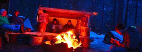
I had lost count of how many days we had eaten lentils and rice. The fire building duty that morning was assigned to a boy I’ll call John, a resident of Project Patch who struggled with self-confidence.
The assistant director of the boys’ dorm, Wes Smith, explained to me that when a young man built a fire, it also helped to build his sense of self. I had recently joined the direct care staff of this non-profit ranch for at-risk youth in Garden Valley and had plenty to learn in my own right—but it was taking John a long while to get the fire started. Continue reading
This content is available for purchase. Please select from available options.
Purchase Only
Purchase Only