Blog Archives

Take the Pend Orielle Plunge

Posted on by Dianna Doisi-Winget / Leave a comment

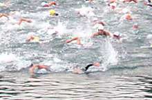
August 10th, 2003, dawned clear and beautiful, promising to be yet another of the many memorable days of that summer when the mercury inched into the nineties or beyond. From my supreme vantage point atop Sandpoint’s picturesque Long Bridge, I could feel the restless excitement of the swimmers on the beach below as we all awaited the beginning of the ninth annual Long Bridge Swim. Soon came the deep bellow of the air horn and over three hundred eager bodies surged into the chilly, but pristine, waters of Lake Pend Oreille. Not just another race, the event has become the Northwest’s premier open water swimming event, attracting participants from all over the western United States.

What makes this 1.7 mile swim so special? Several things. First and foremost is the attraction of Sandpoint itself. Long famous for its lakes, mountains and rivers, this little town of seven thousand also has established itself in the fields of music, art, and culture. But what really makes the Long Bridge Swim unique is the Long Bridge itself—actually two bridges side by side, one for traffic and one a pedestrian/bike path—which offers unsurpassed spectator viewing. After all, how many open water swimming events are there where you can stroll along with the swimmers every step of the way? And what a stroll it is.

Bridges have been a part of Sandpoint’s history for over 120 years, since the Northern Pacific Railroad built the first railroad bridge in 1882, connecting the area to the East and establishing Sandpoint as a bustling mining and timber town. And while mining and timber no longer claim as big a piece of the economic pie, there are still plenty of bridges. In fact, no matter from which direction you approach Sandpoint, you have to cross a bridge.

Anyone who enters Sandpoint from the south on Highway 95 will cross Lake Pend Oreille on the Long Bridge. The view alone has convinced many individuals to make this beautiful North Idaho community their home. And no wonder, with the lake’s clean waters beneath you and the jagged Cabinet Mountains rising against the sky to the east, it’s a view not quickly forgotten. To the north and west, rising sharply behind the town, is the Selkirk Mountain range with backcountry wilderness stretching some sixty miles to the Canadian border. Continue reading

The “23”

Posted on by Will Edwinson / Leave a comment

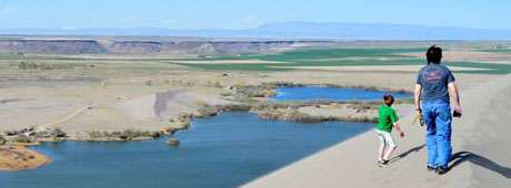
What made this part of Black Canyon unique was the canyon bottom. Standing at the rim of the canyon wall a hundred feet above the river, one could view a piece of God’s artwork at its best. The canyon bottom was formed by molten lava that had flowed, and later hardened, to form a flat surface similar to that of a giant patio. This patio-like canyon floor was approximately a mile and half long and five to six hundred feet wide. Scattered along this giant patio were several large holes that made up the various pools of water where Buddy and his friends enjoyed swimming. They varied in size from twenty-five to forty feet across.

There was a larger pool just down river from the 23 called the “60,” and though the boys swam there also, the 23 was still favored because it was somewhat smaller, which enabled the sun to heat the water to a warmer temperature. Because the water flowed so slowly through this section of Black Canyon, it was nearly stagnant. Not so stagnant that it became foul, but stagnant enough that the sun was able to heat some of the pools to a near tepid state.

Buddy was standing waist deep in the pool on a rock ledge about three feet below the surface of the water. It was about thirty feet across the pool and Buddy wondered if he could make it to the other side. He had mastered the dog paddle pretty well, but he had only dared venture a few feet from the safe haven of the edge of the pool. Although he felt he was ready, he had never mustered the courage to attempt a crossing. Today, he thought, is the day I should try it. Continue reading

Thirty-Six Hours in Idaho

Posted on by Brendan Leonard / Leave a comment

Most Idaho travel brochures won’t tell you that in just two days’ time you can see lava that came from thousands of feet beneath the surface of the earth, a legendary writer’s last resting place six feet beneath the earth, and stand 12,662 feet above the earth. But that’s just what my friend Tim and I set out to do last July.

I had spent most of my summer working at the Post Register in Idaho Falls. Although my internship had lasted three months, I didn’t feel that I knew any more about Idaho than before I came. (Though I could find Rexburg, INEEL and Blackfoot on a map).

Tim and I had two days to see Idaho, so we left Idaho Falls on a sunny Wednesday, shooting west down Highway 20. First stop, Craters of the Moon National Monument.

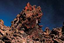
We turned off the highway and followed the loop that cuts through the monument. I tried to keep my eyes on the road but ended up staring out the window at the endless lava fields peppered with sagebrush.

The name “Craters of the Moon” was no coincidence. The entire preserve actually looked like the surface of a barren planet. It was a strange sight in the middle of scenic Idaho, a state I thought was famous for its mountains, valleys, streams, and lakes, not a giant magma wasteland.
Tim and I hopped out of the car at the foot of Big Cinder, the monument’s largest volcanic cone. We crunched our way up the massive black mound and I remembered my high school track days, running hundred-meter dashes on cinder tracks.

“You know, if you jump up and down on this stuff, it feels exactly like jumping on snow,” Tim said, snapping photos of the landscape.
“Yeah?” I said. I immediately began hopping and stomping like I hadn’t done since I was ten years old. It didn’t feel like snow, but there was an odd bounce to it, pushing me back up when I landed. Up and down, up and down, bouncing until I felt embarrassed.
We stood at the top of Big Cinder and gazed over the scenery below: brown and black lava fields and cinder spread over the land where the greens and browns of grasslands should have been. I thought I knew what natural beauty was—the rugged upward juts of mountains, ocean waters rolling on the horizon, the dramatic curves and drops of canyons and gorges. Craters of the Moon was just, well, beautifully strange.
I wasn’t the only one to think so. In the 1924 presidential proclamation that established it as a national monument, Craters of the Moon was called a “weird and scenic landscape peculiar to itself.”

Considering it was midweek, I was surprised to see several other visitors at the monument, driving around the loop and hiking up the cinder cones.

“Most of our visitors are just passing through,” Jim Morris, Craters of the Moon superintendent, says. “We’re between Yellowstone National Park and the Sawtooth Recreation Area. People pick Yellowstone as a destination vacation spot, and they’ll stop here on their way through.”
Two hundred thousand visitors stop at Craters of the Moon every year, and Morris estimates sixty percent of them don’t pick the monument as their “destination” spot.

Tim and I didn’t either. We hopped back in the car and took off down Highway 20 again. Next stop, Ketchum.

When we arrived in Ketchum’s surprisingly cosmopolitan downtown we were instantly surrounded by luxury SUVs and the summer resort crowd who could afford to drive them.

We knew what we had to do. We walked into the Sun Valley/Ketchum Chamber and Visitors Bureau to find out where Ernest Miller Hemingway was buried. Armed with directions to the Ketchum city cemetery and, more importantly, directions to Hemingway’s grave (back row, near the middle), we bolted out the door and sped onward.

At the cemetery, we found Hemingway’s headstone next to that of his fourth wife, Mary Welsh Hemingway. Hemingway’s grave was littered with coins, like a dry wishing well. Tim and I briefly considered collecting the change and using it to pay for our lunch.

“I think if he was still alive, he would have at least bought us a drink,” Tim said.
“You know, I don’t think it’s a good idea,” I said.

We took turns standing near the headstone and taking each other’s picture, proof that we’d been closer to Hemingway than anyone else we knew. Even if he was dead, I thought, paying my respects might bring me some good luck as a writer.

We saw no one else in the cemetery, but we weren’t the only fans who were curious about the grave. Laura Hall, information specialist at the Sun Valley/Ketchum Chamber and Visitors Bureau, says five to seven people come into the visitors bureau every day during the summer to ask about Hemingway.

“The majority of requests for Hemingway are from our male visitors, from college-age all the way up to sixty,” Hall says. “This was his very private place. He never wrote much about it—this was his American getaway.”

Hemingway wrote For Whom the Bell Tolls in suite number 206 at the Sun Valley Resort in 1939. After we visited his burial site, the only item left on our itinerary was our ascent of Borah Peak. I was excited, but infected with a nervous fear of the mountain—I didn’t want to know for whom the bell tolled; it was tolling for me.

Borah Peak, at 12,662 feet, is the highest point in Idaho and pops into the sky along Highway 93 about thirty-three miles south of Challis. As we drove toward the peak, the late afternoon sun painted the trees and valleys in a warm light and took my mind off the next day’s climb until we hit the dirt road leading to the Borah trailhead.

My car rattled over the bumpy road and Borah sat with its head nearly blocking the sun, laughing at us. We set up camp at the trailhead and slept fitfully until just before daylight.

We hiked up the steep trail in the shadow of the mountain, starting at an elevation of 7400 feet. Over the 3 1/2-mile climb, we would gain nearly a mile of elevation. As we pushed on past the treeline, the sun came up over Borah and lit the valley below. Even from where we stood, only halfway up the mountain, the view was spectacular. Deep green circles from irrigation sprinklers hung between ribbons of streams cutting across the valley floor, flat and what seemed like forever away from us.

We stopped for a quick change of clothes after the sun came over the mountain, then pushed on up the ridge. It was a comfortable climb until we met the boulders that mark the beginning of Chicken Out Ridge. From there, we scrambled up and over, trying not to look down on either side, each offering vertical drops one of my co-workers had warned me were “a quick exit off the mountain.”

The last bit of Chicken Out Ridge drops onto a snowfield traverse of about sixty feet to the other side. In celebration of my successful negotiation of Chicken Out, I chicken-danced across the snowfield.

No one laughed.

“Don’t get cocky,” a climber on the other side warned. I was definitely not funny.

The snow crossing behind us, we climbed what felt like straight up a never-ending mess of rocks to the summit. I stood at the top and looked at a 360-degree panorama of peaks: The Lemhi Range, the White Cloud Mountains, the Boulder Mountains, the White Knob Mountains, the Sawtooth Mountains, the Salmon River Mountains, and the Pioneer Mountains, all packaged together in a view that can only be seen by flying or by climbing.

We had reached the summit in a little less than five hours, taking about the same time as the many other climbers we saw that day.

“If you don’t mind the people, Borah is a nice climb within the reach of most advanced hikers,” Jerry Painter, co-author of Trails of Eastern Idaho says. “Summer weekends can be fairly crowded. If you go in the off-season (late September to early July), Borah is a serious mountaineer’s challenge. That’s when you find out it’s a real mountain. In the summer, it’s a kitty. In the winter, it’s a tiger.”

After three hours of running downhill from the summit, we arrived back at the trailhead. We threw our packs in the car and started the drive back to Idaho Falls.

We finished our journey in less than thirty-six hours, and we had worked in as much as we could as fast as we could. We saw the Craters of the Moon, stood next to the grave of a literary star, and got as close to the sun as we could get in Idaho. If the Gem State bordered the ocean, we probably would have taken a dip in that too. But instead we settled for a couple of well-deserved showers. Continue reading

The River in Stone

Posted on by C.W. Reed / Leave a comment

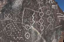
Last fall I was inspired to check out the petroglyph called Map Rock, which is a fairly famous landmark to folks around Melba in Canyon County just south of Nampa, where I was born.

But I was raised in Boise and, to be honest, I hadn’t heard about the rock until my girlfriend Jen suggested we go for a drive. The directions she had taken from a website were vague, and when she had tried to visit the place a couple months earlier, she couldn’t find it.

Her directions described Map Rock Road as a dirt turnoff from Highway 45, which winds along the north side of the Snake River, but we discovered the road is now paved. A couple of miles along it, we found a rest area with a modern pit toilet, for which we were thankful. Although the area sign had said “Map Rock,” we were unable to find any hint of petroglyphs at first. After a bit of hiking along footpaths near the rest area and some confusion as to exactly where we were supposed to be looking, we both became a bit worried that this trip would also end in failure. I pretended to maintain my confidence, because Jen looked like she was losing faith, but it already was apparent that just to find the location was an adventure. We hopped back into the car and drove along the road, looking for any clue that might present itself, or even anything that looked somehow out of place. But it was difficult in the sameness of the rural landscape. Finally, we spotted a site just off the highway, surprisingly less than a half-mile west of the rest area. Maybe this search should have provided fun in its own right, but as I recall it left us a bit testy! Continue reading

This content is available for purchase. Please select from available options.
Purchase Only

Idaho William

Posted on by Jessica Butterfield / Leave a comment

When I planted roots in Idaho in September 2003, I didn’t know it, but I was pregnant, and Idaho was soon to become the beautiful and adventurous place where I would raise my son. In July 2009, when William was five years old, our small family took a camping trip to the same place we had camped the previous July. It was now our favorite spot, off Highway 21 near Lowman, along the Payette River, where I fell in love with Idaho and country music. Alan Jackson’s “Country Boy” could be heard on every country station and I grinned ear to ear every time I heard it, because I could look back at William in his car seat singing, “Up city streets, down country roads, I can get you where you need to go, ‘cause I’m a country boy.” We still sing that song.

We spent our time during the camping trip making sand castles along the river, writing our names with pine cones, hiking the easy path near camp, and reading books. We tied up the raft to float on the shallow, calm nook of water nearby, and if we stayed still enough while we lay in the raft, butterflies would land on our hot, sticky skin. William loved that.

We took car trips from our campsite to let him see the majestic Sawtooth Mountains and to swim in the ice-cold water of Redfish Lake. We stopped in Grandjean for huckleberry ice cream cones, showed William the hot spring in the river, and told him the story from a previous visit to the area of how we saw a bear run down the mountain to drink, and how scared I got seeing a bear in the wild for the first time. That night as we ate hot dogs, we watched an eagle fish in the river and bring food to its nest in the tree above. It was a hot, windy camping trip that encouraged a lot of exploring, sprouted many ideas, and almost took my son’s life. Continue reading

This content is available for purchase. Please select from available options.
Purchase Only

Alone

Posted on by Doug Tims / Leave a comment

I’m a licensed pilot. I flew my own plane for sixteen years, but I was glad not to be at the controls as we made the approach for this landing. It is stunningly beautiful. And scary: mountain peaks, canyons, strong tricky winds, towering ponderosa pines and grand firs with a tight, short runway cut among them.

Ray Arnold, a veteran mountain pilot, was in the left seat, I was in the right, Phyllis in the rear seat of the single engine Cessna 206. We were coming from Cascade, had flown over 8,346-foot Chicken Peak and were looking down on two-and-a-half-million acres of the Frank Church–River of No Return Wilderness stretching for miles in all directions. It’s a mountainscape that has always attracted tough men and women. A lonely Eden, and, for some, a garden of agony.

At about three thousand feet, Ray banked the plane steeply and finally put us down on the eight-hundred-foot runway that sits on a sloping meadow above the river crossing called Campbell’s Ferry.

We thanked him, unloaded our twenty-odd boxes of gear and watched as the little plane clawed into the air headed straight for the canyon wall across the river. The plane banked left to find the deep canyon opening downriver, banked again to follow the narrow cut, rounded the bend at Lemhi Point and was gone, leaving only the sound of the Salmon River as it made its way past the historic homestead that would be our home. Continue reading

This content is available for purchase. Please select from available options.
Purchase Only

Climbing the Waterfall

Posted on by Mark Weber / Leave a comment

The sheer rock walls of the Snake River Canyon are laced with sinewy waterfalls during temperate months, but with the onset of winter and plummeting temperatures, these delicate cascades freeze. Taking on the form of veined curtains of glass and columns of crystal, this transient world becomes a frozen palace where the ice climber reigns.
For more than two decades I have sought out the bizarre adventures of this fragile kingdom, and I’m not alone in pursuit of it. Other climbers also have been visiting these ice formations for years, and these days I often am accompanied by my son Elijah and various friends, such as longtime climber David Weber, to whom I’m not related except in our passion for climbing ice.

“Ice climbing? It looks crazy to me. Too dangerous. No offense, but I think you are truly insane.”

How many times have I heard that argument from casual observers? And on some level I have to agree. Continue reading

This content is available for purchase. Please select from available options.
Purchase Only

Missing Gene

Posted on by Angela D'Ambrosio / Leave a comment

My husband Rick says my side of the family is missing a self-preservation gene. I hadn’t really considered it until my mother and father decided to build their dream house at the top of maybe one of the most dangerous roads in America.

Admittedly, reaching the summit is like breaching the gates of heaven, but it’s six miles of sheer rock cliffs and narrow thoroughfares just big enough for a single vehicle. And that’s the improved road.

The suspect road is an old logging trail that branches off Highway 95 in the mountains near Council. My dad, Jim Warren, had to dynamite parts of that road, which my kids lovingly call “the scary cliff.” We’ve actually convinced the kids that we installed a parachute on the mini-van just in case we fall off the cliff. It is always a life-affirming journey to Grandma and Grandpa’s house. Continue reading

This content is available for purchase. Please select from available options.
Purchase Only

Lentils and Rice

Posted on by Francisco Lozano / Leave a comment

I had lost count of how many days we had eaten lentils and rice. The fire building duty that morning was assigned to a boy I’ll call John, a resident of Project Patch who struggled with self-confidence.

The assistant director of the boys’ dorm, Wes Smith, explained to me that when a young man built a fire, it also helped to build his sense of self. I had recently joined the direct care staff of this non-profit ranch for at-risk youth in Garden Valley and had plenty to learn in my own right—but it was taking John a long while to get the fire started. Continue reading

This content is available for purchase. Please select from available options.
Purchase Only

After Summer

Posted on by Rachel Gattuso / Leave a comment

Our snowmobiles sliced through tall, blackened trees, casting high-pitched whines into the sparsely populated terrain.

We followed the path’s endless S-curves as they opened before us. The trees seemed stripped of significant limbs, barren and lifeless. But in the pure white, the black trees racing by were hypnotic. The four of us, who were on the tail end of a day spent snowmobiling in Stanley, had driven into the stoic remains of a wildfire. Yet as we zipped through the quiet folds of the countryside, these charred trees seemed whitewashed, given a new look by the snow. The ghost pines stretched to the sky, painting an eerie picture.

If I could show you a picture of this backwoods scene, surely you would be reminded of how, even in large-scale destruction, there is beauty and new life. But that day I brought my phone instead of a regular camera. Such an incredible piece of technology will cut down the number of gadgets I carry, I reasoned. Unfortunately, I discovered that the fancy thing turns off sporadically in extreme temperatures. The lanky trees in their grim splendor, my favorite image of the day, will have to live in my memories.

I should back up about four years. The first time I drank in the power of the Stanley Basin, I had just emerged from a room at the Mountain Village Resort with camera in hand. The craggy peaks of the Sawtooth Range were drenched in blinding white snow and crowned with a bluebird sky. It was a postcard come to brisk (I could see my breath) life, and it took a minute before I remembered to snap a shot. For a few moments, as the Sawtooths loomed in front of me, I was powerless to look away. They consumed me wholly, marched right into my world and planted a bold flag.
Continue reading

This content is available for purchase. Please select from available options.
Purchase Only

JOIN US ON THE JOURNEY