No products in the cart.
What the Floods Wrought

Tracing the Origins of Contemporary Idaho
Story and Photos by Max Jenkins
For a long time, I didn’t understand why the terrain varied so widely throughout much of Idaho. This mystery arose in my boyhood, after our family moved to Grangeville in 1946. My mother’s family lived in and around American Falls and Pocatello. Following our move, Dad promised Mom we would make a trip each year to see her relatives. And he kept his promise. Our annual excursion to southern Idaho took ten hours and passed through numerous geological changes.
Each year, the first driving challenge on the trip was to navigate the many switchbacks of the old White Bird Grade. I looked forward to it. Dad would stop for me to get out, and I’d run down to the next switchback, where he would pick me up. We repeated this routine three or four times before entering the village of White Bird. (This changed in 1975, when a new highway over White Bird Summit was constructed.)
Our family’s annual trek continued south to Boise and then onto Highway 30, which entered the desert surrounding Mountain Home. Dad and I complained about the ugly countryside but Mom had grown up on the southwestern side of Craters of Moon and saw beauty in the desert. She pointed out rock structures on the treeless, brown mountains, especially as we got closer to Twin Falls. Dad and I were unconvinced, maintaining that the state’s north was far prettier than its south.
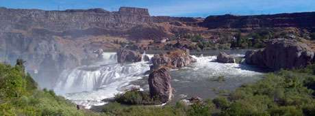
Highway 30 followed the Snake River much more closely than do today’s freeways. Mom directed our attention to rocks that looked like black vehicles parked above the river. When we entered Twin Falls, Dad invariably drove right to the Snake River Canyon. “What a spectacular sight,” he declared every time. Then he’d say, “Max, don’t ask me again what caused the canyon.”
This content is available for purchase. Please select from available options.
Purchase Only
Purchase Only

